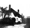
View of Broad End from close to Smith Street dated 1910.

View down Broad End from close to Smith Street, probably in the 1930s. A water standpipe is visible along with a water cart. The piped water supply was only installed 1931-1932.

View of Broad End from the south probably in the 1930s. A large trailer is parked in front of the water standpipe.

A picture of Broad End after 1940 as electricity poles can be seen. The old water standpipe can also be seen on the right hand side of the road, presumably disused by now.

Ivy Fold in the early 20th century. The appearance of the front of the building has not changed a great deal.

View of Broad End sometime in the late 1940s or 1950s. Telegraph poles and wires can be seen in the picture and these may be electricity or telephone wires.

Another copy of the picture to the left which was posted. The reverse of the postcard is shown on the right.

This is the reverse of the postcard to the left and is postmarked 11th July 1949 and sent from Elsworth.

Looking southwards along Broad End from opposite Ivy Fold, probably in the early 1900s. The road seems to be gravel and Alma Cottage, Lords Farm and Meadow Farm can be seen in the left. The cottage on the roadside in the forground has long since vanished.

A view of Broad End showing what is now Horseshoe Cottage with Meadow Farm and Lordship Farm in the background. This picture probably dates from the 1920s as there are no telephone or electricity poles and the road is unpaved. The man standing outside Meadow Farm is Roland Warboys.


Broad End in the early 20th century. The cottage alongside the road opposite Ivy Fold has since vanished. The photo on the left (a photocopy) seems to be the original of the one on the right and is captioned "ELSWORTH VILLAGE" and "R T Bellamy", presumably the photographer.

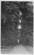
This appears to be a picture of Water Lane from the Rogues Lane end. The caption describes it as "The Glen".

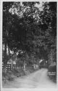
The appears to be another view from the Rogues Lane end of Water Lane towards Broad End. This picture is captioned "Lovers Walk" but seems to have been mirrored in printing. Lordship Farm seems to be on the left in the distance.

The new primary school built in Broad End after the closure of the original school in Brook Street. The new school was opened in 1954.
The original school shown here has been greatly extended since.

Elsworth school after the first extension, that of the hall. The extra section built onto the end can be seen by the difference in the colour of the roofing.

The base for the second of a number of extensions to Elsworth School to provide extra classrooms as pupil numbers increased.

The base for the school extension showing the original school classrooms. The bricked up door led to the playground.

Elsworth school 1979-1981 showing the new extension completed.

In 1974 main drainage came to Elsworth. Here pipes are stacked by Broad End ready to be laid.

Main drains being laid in Broad End close to the school in 1974.

A small bungalow built next to the school. It is now called "The Chimneys" and has been extended in recent years.

Flooding in Broad End in the spring of 1983 seen from Meadow Drift.

Flooding in Broad End seen from the end of Water Lane in the spring of 1983.

The site for sheltered housing on the corner of Broad End and Fardell's Lane in 1985.

The sheltered housing site seen from outside Elsworth school in 1985 before building started.

The site for the Broad End sheltered housing being cleared in 1985.

Sheltered housing under construction in Broad End 1985.

Sheltered housing the Broad End nearly completed.

The sheltered housing in Broad End in winter before completion.

View along Broad End during the 1980s.

Ivy Fold sometime in the 1980s.

Ivy Fold in the 1990s. The house has been extended since.

The view along Broad End from the entrance to the sports field in the 1990s. Horseshoe Cottage, Meadow Farm, Lordship Farm and Alma Cottage can be seen along the western side.

The sheltered housing in Broad End in the 1990s.

A fairly modern house built at the Smith Street end of Broad End in the late 20th century.

The view along Broad End in the 1990s. From right to left Lordship Farm dates from 1850, Meadow Farm from 1840.

The old pavilion in the 1990s, not long before it was replaced with a new pavilion. In front of the pavilion is a bench made by the Throssells consisting of two concrete end and wooden slats. One of these benches has recently been restored.

The Broad End entrance to Water Lane seen in the 1990s. It has become overgrown since then and is no longer used.

A 1960s house, one of two of this type built on the old farmyard of Lordship Farm. This house was formerly called "Fairfield" in the 1990s but has since been renamed.
The concrete driveway was originally part of the old farmyard.

One of the original cottages in Broad End, Alma Cottage has been modernised and extended over the years. It is situated next to "Fairfield"; the sign can be seen on the left of the cottage.

Alma Cottage from the north with converted farm buildings in the background.

A modern house built on a plot between Alma Cottage and the school. Previously a cottage stood on the plot.

The village allotments in Broad End, during the 1980s. The allotments were originally in the central paddock opposite the Fox and Hounds pub (now The Poacher). The new location is less convenient for the pub.

A modern bungalow built in the 1980s at the southern end of Meadow Drift close to where it joins Broad End.

This shed was used for storing potatoes when these crops were grown locally. It fell into disuse when potato farming ended and has since been demolished.

A reservoir built by the Meeks family when they owned the farm to irrigate root crops such as potatoes. When such crops ceased to be grown the reservoir was stocked with fish and is now used by anglers.

Another view of the reservoir which was built in the 1960s. It was filled in winter by pumping water from the brook that ran past it. A power line was run to the reservoir to run the pumps.